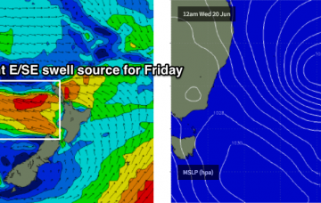
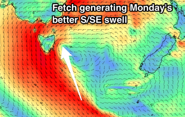
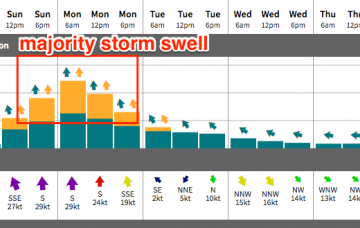
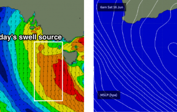
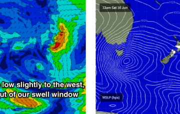
Large southerly storm swell late Sunday and Monday
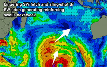
Monday will see a peak in short range southerly storm swell, with strong to gale force winds accompanying form the same direction.
The synoptic chart looks very impressive with a deep low immediately to our south, and Cape Sorell buoy showing a lot of energy - however the main fetch around the western flank of the low is outside our swell window, aimed up into SA and western Vic.
A longer, broader and more favourably positioned S/SE fetch will develop east of Tasmania on Monday and this will be a better source of quality groundswell through Tuesday and Wednesday.
For my money, you’re best off flagging the start of the week and aiming for Wednesday through Friday.
Unfortunately, all of this swell will largely go to waste at Victor thanks to accompanying southerly gales.
No surprises for the weekend, with a significant cold outbreak impacting the entire state.
Good new long-period S/SW groundswell for tomorrow afternoon, easing Saturday with some new long-period energy building Sunday and holding Monday morning, with larger SW swells into the afternoon through Thursday.
Good new long-period S/SW groundswell for tomorrow afternoon, easing Saturday with some new long-period energy later Sunday and Monday, with larger SW swells Tuesday through Thursday next week.
This has had a dramatic effect on our surf outlook.
Building S'ly windswell Sunday, easing Monday with average winds, cleaner and smaller Tuesday.