Strong, easing swells from Tuesday; windy south swell Saturday
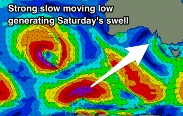
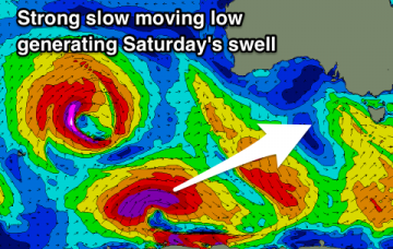
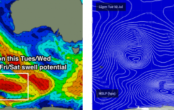
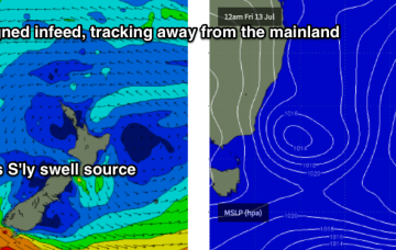
The strong, broad post-frontal fetch responsible for today’s impressive south swell is now exiting our swell window.
Much better conditions tomorrow down South with a good sized easing S/SW swell, smaller Wednesday with a limited window of clean conditions. Average end to the week, much better on the weekend with a new groundswell and great winds.
Good run of waves from tomorrow through the weekend with fun swells and favourable winds.
We’re still on track for a new pulse of long range groundswell to arrive through Sunday morning.
The Southern ocean storm track is finally swinging into our swell window, and we’re looking at a couple of days of large south swell though with accompanying gales from the W/SW the’ SW.
Here it comes: after an extended period of tiny, blowy conditions we’re about to see a major upswing in wave heights as the storm track finally aligns properly in our swell window.
The low pressure system driving this front is a beauty, and it’s aimed fair and square into Kangaroo Island.
The swell charts are suggesting some serious size (and wind) over the weekend, but I’m still a little cautious. Confidence that you'll pick up great waves this weekend is certainly not high at all.
Today’s easing trade swell will continue its downwards trend into the weekend, but winds will swing W/NW across northern regions and W/SW across southern regions, resulting in clean beachbreaks.
Sunday however is still on track for a strong south swell to build through the day as a strong series of fronts push through the lower Tasman Sea.