Slower period, best on the weekend
Monday, 14 March 2022
Slower period, best on the weekend
Monday, 14 March 2022
Average winds over the coming days with a weak swell, better on the weekend.
Average winds over the coming days with a weak swell, better on the weekend.
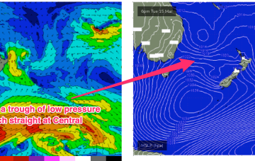
That SE fetch now dips away from Tas on Wed, with an E/NE fetch off the south side of the high aimed spat the East Coast.
The sheer longevity of the wind field maintain a rideable signal of surf for most days this week.
There's some larger surf on the cards this period with more action on the metro beaches but winds are a little dicey.
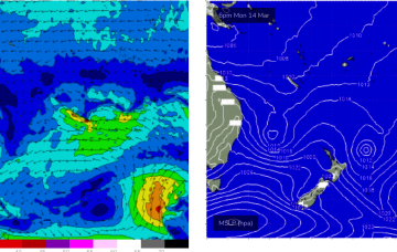
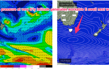
A stronger high at at even more Southerly latitude is South-west of Tasmania and tracking into the lower Tasman to replace the current high cell. This will reinforce the SE’ly fetch and maintain a weak onshore flow on the coast.
Lots of surf days this period, initially down South and then on the Mid Coast.
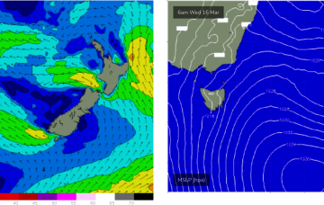
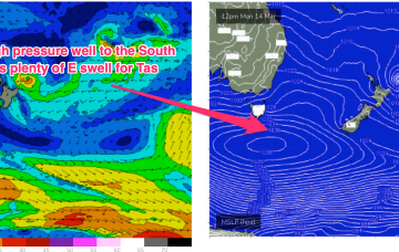
The current high cell in the Tasman has a trough of low pressure perched atop it, maintaining an E’ly fetch at a southerly latitude- roughly due East of Sydney.
Good surf days for the beaches apart from when it gets too big. There's a moderate to large swell in the mix as well.
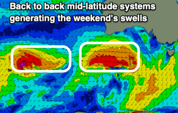
Into the middle of next week and a robust fetch of E’ly winds extending out from Tasmania into the Tasman Sea, generated by the large high will maintain a solid level of E’ly swell.
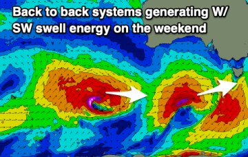
That will set up a fresh ridge of high pressure along the f/cast region over the weekend.