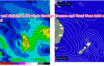
Easing surf ahead of larger energy into the weekend
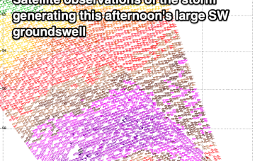
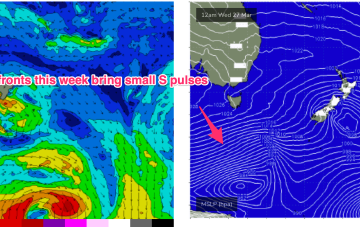
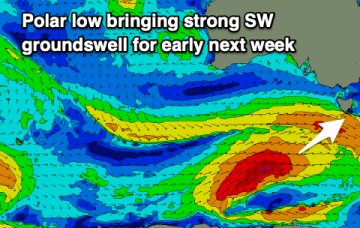
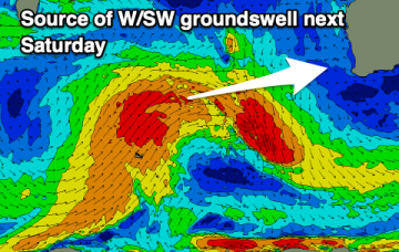
We've got easing surf from here on until Thursday, with a larger W/SW groundswell arriving late Friday, peaking Saturday.
We’ve got an extensive high pressure belt with weak cells in the Tasman and near Indian Ocean and a stronger cell in the Bight. Compared to summer high pressure we’re seeing a slight seasonal shift northwards in the belt although later in the week the strong high in the Bight does move towards Tasmania at a more typical summer latitude.
For now, frontal activity is being allowed to track in a more favourable manner for S swell production so we’ll seea week of small/moderate S swell pulses leading into the Easter weekend.
We've got plenty of swell due out of the south with mostly light morning winds this period.
For now, frontal activity is being allowed to track in a more favourable manner for S swell production so we’ll see a week of small/moderate S swell pulses leading into the Easter weekend.
The coming days look fun for protected spots with plenty of swell along with favourable winds. The end of the week will favour the beaches, followed by a period of average surf.
We've got plenty of swell for the period with the favourable wind outlook holding.
The weekend will see clean, easing surf, with nothing major due next week. A large mix of swells are due next weekend.
Weak high pressure in the Tasman is seeing a dissipating tradewind fetch in the Coral Sea so we’ll finally see this run of surf wind down over the weekend, becoming tiny likely by Sat a’noon into Sun.
S swells from frontal activity now look a notch more active next week as the W-E progression of the next high cell (and subsequently fronts) slows and allows more intrusion into the lower Tasman.