Good Mid Coast run with dicey winds for the South Coast
Wednesday, 26 February 2025
Good Mid Coast run with dicey winds for the South Coast
Wednesday, 26 February 2025
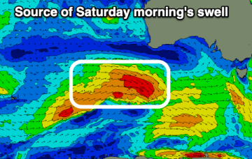
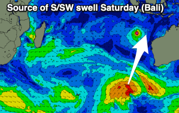
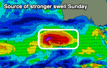
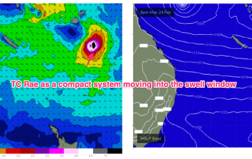
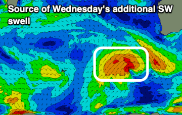
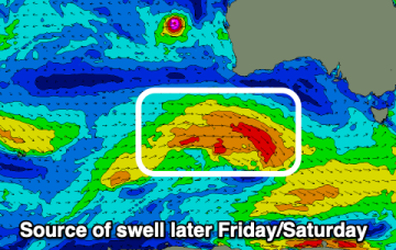
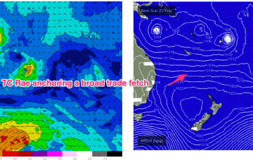
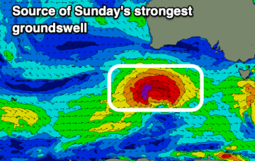
We've got three, back to back swells for the Mid Coast with OK winds, average down South.