Plenty of fun tradewind swell ahead with winds improving over the weekend
Wednesday, 2 August 2023
Plenty of fun tradewind swell ahead with winds improving over the weekend
Wednesday, 2 August 2023
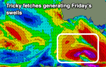
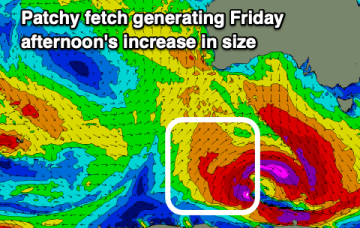
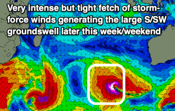
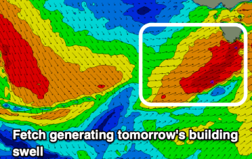
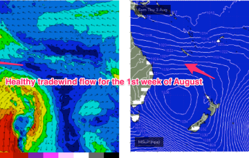
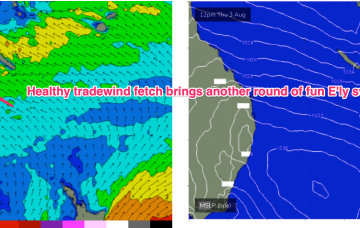
In the wake of a strong front earlier this week we have still have moderate S swell trains propagating through the Tasman Sea which will be one swell source through the short term. The bifurcation between the sub-tropics and temperate regions increases through the end of the week with NE windswell in the temperate areas and E’ly tradewind swells building in the sub-tropics.