Size downgrade but conditions improve opening up beachies by mid-week
Monday, 22 April 2024

Size downgrade but conditions improve opening up beachies by mid-week
Monday, 22 April 2024
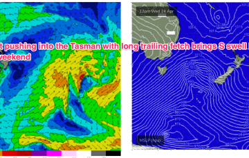
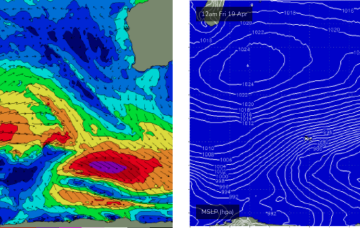
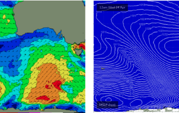
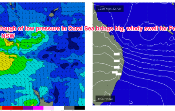
We’ve got a dominant (1035hPa) high pressure cell sitting just north of the Victorian border, bringing settled conditions and light winds to Central/Southern NSW and strong but easing SE winds in the sub-tropics where a trough of low pressure in the Coral Sea is currently active but dissipating and moving East.