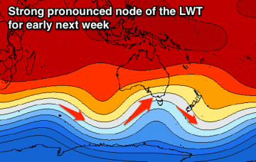
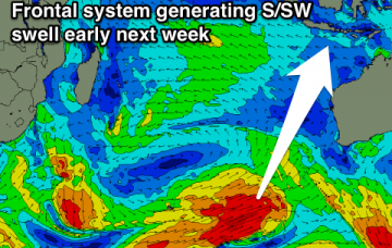
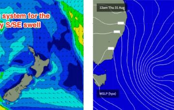
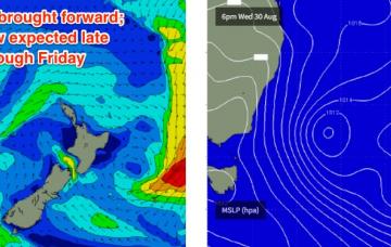
Another round of strong south swell ahead
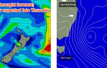
The current E’ly swell is modeled to hang into Thursday morning of a similar size as per today, before easing slowly throughout the afternoon.
Friday still looks like the pick of the next few days.
Easing S/SE swell tomorrow with a building E/SE swell Friday, easing slowly Saturday with winds from the northern quadrant. Easing further Sunday but mixed in with a peaky N/NE windswell Sunday.
Fun easing SW swell tomorrow, further Friday with clean conditions. Small inconsistent W/SW swell for Sunday afternoon and more complex outlook next week.
Building SW swell later Friday, peaking Saturday with onshore winds across all locations. Easing surf Sunday as onshore winds persist across the South West, cleaner to the north. Good large S/SW groundswell for Monday with offshore winds.
New S/SW swell tomorrow morning with offshore winds, easing into Friday and further Saturday. Mix of building W/SW groundswell and stormy swell building Sunday, large cold and stormy next week.
Mix of easing S/SW and SW swells with light winds tomorrow morning, offshore and fun for the beaches Friday through Sunday morning. New inconsistent W/SW swell for Sunday afternoon then larger developments next week.
Building long-range and very inconsistent SW groundswell tomorrow afternoon, peaking Thursday afternoon, easing into the weekend with a more consistent and slightly larger S/SW swell for early next week.
Building long-range and very inconsistent SW groundswell through the end of the week, easing into the weekend with a more consistent and larger S/SW swell for early next week.
Strong southerly swells from the Tasman Low will fill in across Northern NSW overnight, but then trend down fairly quickly from Tuesday lunchtime onwards.