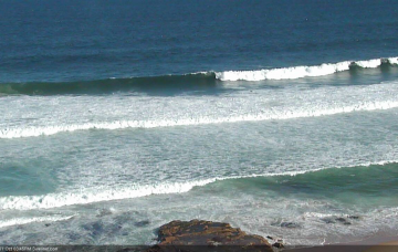
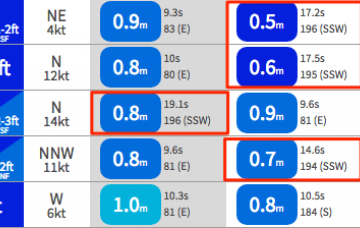
Smaller long-period swells this period out of the south
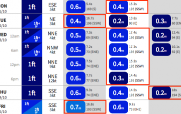
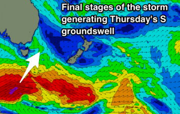
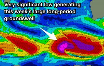
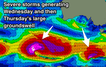
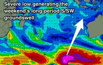
New S/SW groundswell building tomorrow, easing into the end of the week ahead of a new long-period S/SW groundswell for the weekend.
It seems as if there’s a thousand inbound swell sources throughout the forecast period, and that my head may explode. But, let’s get on and into it.
A couple of good pulses of S'ly groundswell this period but winds are an issue. Easing as some new E swell fills in.
It doesn’t get much more complex than what we have in front of us right now. We've got a wide range of swells and possible an East Coast Low forming later in the week.
Generally favourable and workable winds through the coming period to match the swell size.
A large long-period SW groundswell is due through the week with offshore winds, easing into the end of the week as winds deteriorate.
Drop in swell tomorrow with offshore winds, ahead of a large groundswell to end the week but with average winds.
Easing surf tomorrow ahead of a good new SW groundswell mid-week with a window before winds go onshore. Large SW groundswell to end the week, easing slowly into the weekend but winds are an issue.
Looking further afield, and we’ve got some interesting developments elsewhere, with deepening tropical activity south of Fiji broadening a surface trough through the north-eastern Tasman Sea through the first half of the week, forming an impressive E/NE fetch that’ll probably stretch way out into the South Pacific.
The synoptic are really busy for next week, and we have a wide variety of tricky swell sources on the way. In fact, most of the likely energy we’ll see will be generated from distant sources off the usual charts.