Stormy S/SE windswell for the weekend
Friday, 24 November 2023
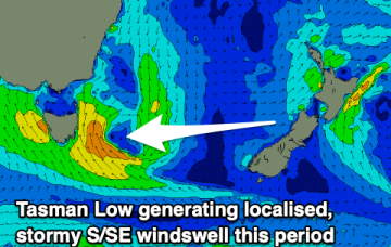
Stormy S/SE windswell for the weekend
Friday, 24 November 2023
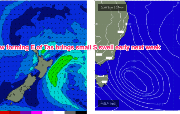
The coming period is generally poor thanks to a low forming to the south-east of the state.
The coming period is generally poor thanks to a low forming to the south-east of the state.
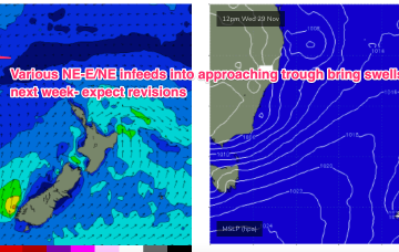
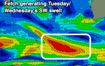
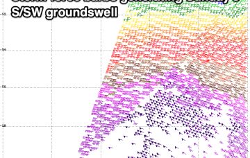
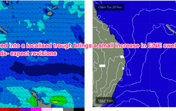
By Wed we should see another building trend as another trough deepens in Southern NSW/Gippsland and a strong infeed into the trough builds E/NE swells.
Conditions will be windy and clean over the coming days with no swell. Some new swell is due through next week but with average winds.
There'll be a window of OK conditions in protected spots tomorrow morning, then poor until later next week.
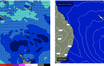
High pressure is straddling Tasmania with the remnants of a front lingering near New Zealand with an off-axis fetch. A coastal trough and an inland trough maintain unstable conditions with a developing N-NE flow over the weekend.
Not a great deal of action likely this weekend. High pressure is straddling Tasmania with the remnants of a front lingering near New Zealand with an off-axis fetch. A coastal trough and an inland trough maintain unstable conditions with a developing N-NE flow over the weekend.
Get in across the beaches today and tomorrow ahead of a poor, windy period of surf.
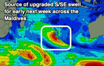
Indonesia remains small, while the Maldives will provide a good swell early next week.
The coming days will see fun surf with workable winds, stormy and onshore into the weekend.
It’s a weak synoptic pattern with no major swell sources and especially light winds across the Coral Sea.That will keep this f/cast update short- no surf to speak of.