Lots of small/tiny days ahead
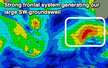
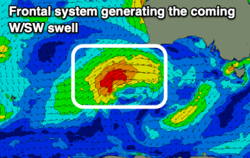
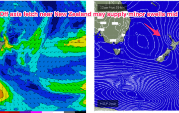
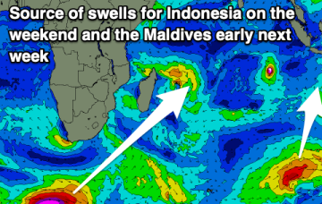
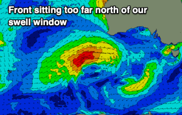
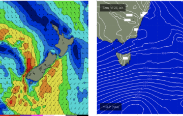
Absent that, with weak high pressure in the Tasman we’ve only got local wind swells to keep wave zones active this week, and into next. Let’s take a look.
A large swell is due tomorrow though winds will favour selected spots, with cleaner conditions due as the swell eases.
After an extended period of eyes on the tropics there’s not too much to get excited about as the current E swell event winds down. We’re still waiting for TC Kirrily to form (already called by the Joint Typhoon Warning Centre) and when it does it’s expected to take a straight SW-W/SW track into the NQ coast, crossing around Townsville tomorrow evening. No swell of any significance is expected from this system south of the border- with only marginal N/NE swells showing at a few spots in QLD (mostly north of K’gari (Fraser Is))
A fun run of W/SW swell is due from late week though cleanest on the weekend as it slowly eases.
Absent that, with weak high pressure in the Tasman we’ve only got marginal, local wind swells to keep wave zones active this week, and into next.
The end of the week is generally average with some good W/SW swell due on the weekend with favourable morning winds. The beaches look best again early next week.
A fun swell for the weekend in Indo, early next week across the Maldives.
All the headline action is in the tropics with a cyclone (TC Kirrily) expected to form within the next 24-36hrs in the monsoon trough NE of Cairns. A coastal crossing in N.QLD now looks the most likely outcome with some surf potential for the CQ region, at least in the short/medium term.
NE winds off the South Coast extend down to Bass Strait and freshen o/night Tues into Wed with increasing NE windswell expected Wed.
There's nothing major due this period but there are lots of small, fun surf days.