Indonesia/Maldives forecast February 14
Thursday, 15 February 2024
Indonesia/Maldives forecast February 14
Thursday, 15 February 2024
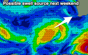
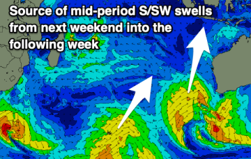
A bit more swell potential from next weekend.
A bit more swell potential from next weekend.
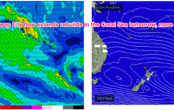
Multiple cells of reinforcing high pressure then one by one move into the Tasman, maintaining a weak ridge up the NSW Coast and a deep E’ly flow through the South Pacific and Eastern Coral Sea, with resulting E’ly swells favouring the sub-tropics for size, with a rebuild in size expected later this week.
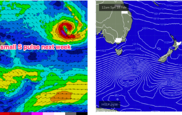
Multiple cells of reinforcing high pressure then one by one move into the Tasman, maintaining a weak ridge up the NSW Coast and a deep E’ly flow through the South Pacific and Eastern Coral Sea, with resulting E’ly swells favouring the sub-tropics for size with some small E/NE swell filtering down to NETas. More cold fronts and small S swells are also on the radar.
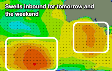
There's plenty of swell due this period but with tricky winds.
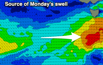
Following this morning's swell, we've got less favourable winds and generally smaller surf for the period.
Multiple cells of reinforcing high pressure then one by one move into the Tasman, maintaining a weak ridge up the NSW Coast and a deep E’ly flow through the South Pacific and Eastern Coral Sea, with resulting E’ly swells favouring the sub-tropics for size, with a rebuild in size expected later this week.
Our current pattern of slow moving high pressure near New Zealand is still well entrenched with a modest cold front sweeping into the Tasman and bringing a S’ly change to temperate NSW. Multiple cells of reinforcing high pressure then one by one move into the Tasman, maintaining a weak ridge up the NSW Coast and a deep E’ly flow through the South Pacific and Eastern Coral Sea, with resulting E’ly swells favouring the sub-tropics for size.
A good swell for tomorrow will be met with OK winds, with similar, workable windows due into Friday and the weekend.
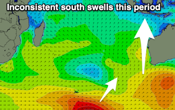
The wind outlook is better for tomorrow so make the most of it with workable but not so perfect waves on the weekend.