Tricky period of weak swells and varying winds
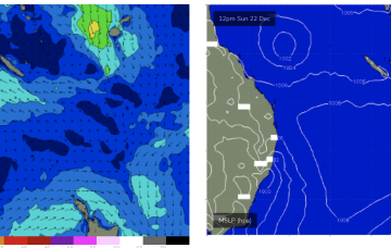
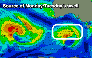
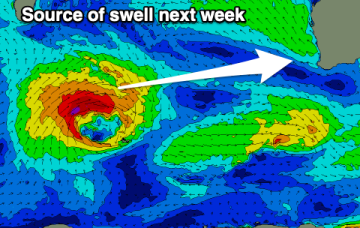
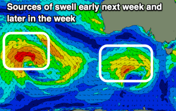
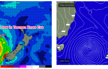
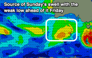
The coming period is tricky regarding the timing and sizes of incoming swell pulses, but there are a few reliable days.
Over the weekend the monsoonal low moves out into the Coral Sea with a weak fetch of winds along the southern flank. That fetch shield be enough to generate some small E’ly swell later Sun into Mon.
O/night Sun into Mon we’ll see a low form off the Gippsland Coast and begin to deepen rapidly through the morning.
Winds look poor when the swell reaches 2ft.
Southerly winds will create tricky conditions next week when a strong pulse of new W/SW groundswell fills in.
The coming period looks mostly average for the South Coast apart from a couple of windows next week with small to tiny swells on the Mid Coast.
Still looking good for Sat. Current ASCAT (satellite windspeed) pass shows a Tasman low with a long fetch of strong S-S/SE winds well positioned in the swell window.
Current ASCAT (satellite windspeed) pass shows a Tasman low with a long fetch of strong S-S/SE winds well positioned in the swell window. Concurrently, weak high pressure is moving NE to be off the sub-tropical coast o/night and into tomorrow morning.
It won't be until Christmas day that we see the winds back off and surf clean up.
Swells of slightly less size due this period.