Indonesia/Maldives forecast June 25
Tuesday, 25 June 2024

Indonesia/Maldives forecast June 25
Tuesday, 25 June 2024
The weekend and next week should provide a bit more swell activity.
The weekend and next week should provide a bit more swell activity.
A sub-tropical low north of the North Island scooted away to the SE over the weekend and as a result the long range E/SE swell is likely to be closer to 1-2ft than 3ft with just the occ bigger set across open Burnett coast exposures.
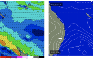
Models have been flip-flopping but we are starting to have some confidence on a frontal system and the cut-off low entering the Tasman this weekend or early next week.
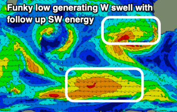
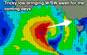
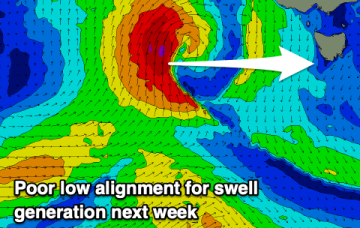
A meandering mid-latitude low will bring tricky pulses of swell and varying winds this week.
A sub-tropical low north of the North Island scooted away to the SE over the weekend and as a result the long range E/SE swell is likely to be closer to 2ft than 3ft.
It'll be windy but good across the South Coast tomorrow, smaller but fun into the rest of the week.
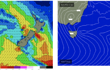
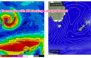
The Tasman Sea, by contrast, is looking very mellow with a weak high pressure cell over NSW and a few decaying remnants of the long lasting Tasman Low sitting near New Zealand. Those weak pressure gradients across our main S-SE swell window will lead to a very quiet week swell wise, with mostly offshore winds.
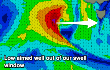
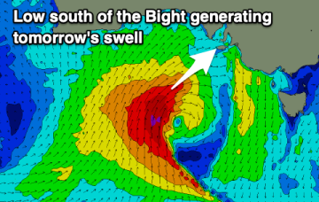
We've got a tricky period thanks to unfavourable (for swell production) back to back meandering lows in the Bight.
Make the most of the swell spike on the weekend.