Fun S swell tomorrow
Monday, 19 August 2024
Fun S swell tomorrow
Monday, 19 August 2024
Make the most of tomorrow's S'ly swell ahead of another slow period.
Make the most of tomorrow's S'ly swell ahead of another slow period.
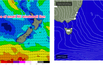
High pressure systems are looking weak and mobile as befits the changing seasons, tracking NE into the Tasman and bringing a N’ly flow across sub-tropical to temperate regions but holding enough strength in the Coral Sea to generate some small rideable waves from mid-week.
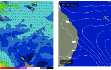
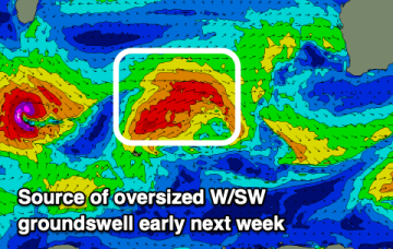
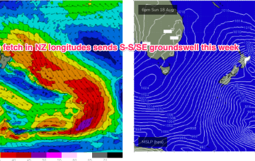
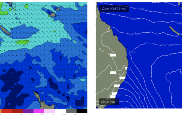
A deeper fetch now operating near New Zealand longitudes is better aimed at Pacific targets (some to Fiji, most to Tahiti) with some strong sideband S/SE groundswell due tomorrow.
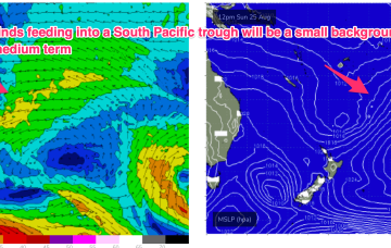
The coming period looks active but windows for a clean surf look generally limited.
A deeper fetch now operating near New Zealand longitudes is better aimed at Pacific targets (some to Fiji, most to Tahiti) with some sideband S/SE groundswell due through the middle of this week.
A deeper fetch now operating near New Zealand longitudes is better aimed at Pacific targets (some to Fiji, most to Tahiti) with some sideband S/SE groundswell due through the middle of this week.
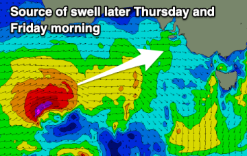
The coming days are a bit more miss than hit with a fun spike in swell due later week.
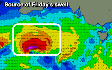
The coming days are most favourable for the beaches with some Surf Coast action late week.
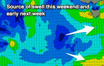
Swells from the south this period, poor on the weekend.
Our summer-style swell producing pattern has broken down and we’re seeing surf ease into the weekend, becoming tiny into next week as high pressure moves towards Tasmania.