Good westerly energy to end the week
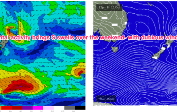
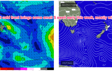
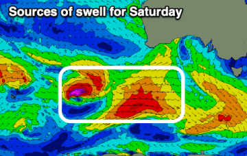
The Mid Coast will continue to provide good surf into the end of the week and weekend with healthy westerly swell pulses.
The current S swell will ease through tomorrow with a pair of cold fronts passing into the Tasman Thurs/Fri ahead of another trough and high pressure ridge. In short, we’ll see pulses of S swell but favourable winds will be short-lived.
There's a bit of size due on the weekend but with average winds Saturday, better Sunday.
Lots of activity this period, large next week.
Swells will build with wind and then ease as conditions improve.
A stronger high moves through the Bight over the weekend and looks to set-up a SE surge possibly as early as Mon. There is some model divergence leading to low confidence but all major models are suggesting SE winds building through the Coral Sea next week.
Into next week, a polar low passing through the Southern ocean late next weekend looks to send some long period S swell up the pipe early next week
We’ve currently got a cold front linked to a compact parent low moving across and SE of Tasmania with high pressure tracking through the bight towards Victoria. That will bring a robust S’ly change tomorrow and some workable S swell for temperate NSW, with a trough in the sub-tropics tilting the change more S/SE-SE later tomorrow into Wed.
We've got a couple of good swells due this week with improving conditions, XL but onshore next week.
That will bring a robust S’ly change tomorrow and some workable S swell for temperate NSW, with a trough in the sub-tropics tilting the change more S/SE-SE later tomorrow into Wed.