Small surf filtering down from the tropics continues
Wednesday, 26 February 2025
Small surf filtering down from the tropics continues
Wednesday, 26 February 2025
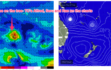
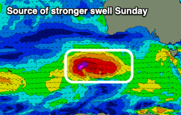
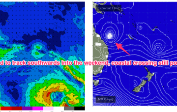
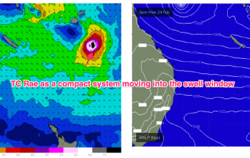
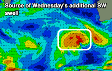
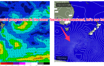
High pressure is in the Tasman with three tropical cyclones currently on the map. NETas will see some smaller surf from these systems as well as NE windswell.