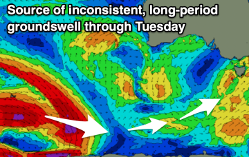
South, south, south
Monday, 8 September 2025

South, south, south
Monday, 8 September 2025
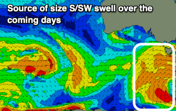
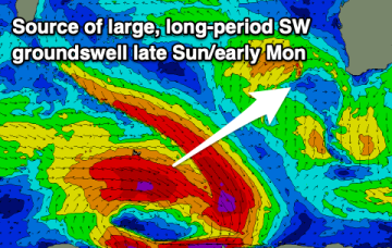
We've got multiple pulse of southerly swell on the cards from Wednesday through the weekend and beyond.
We've got multiple pulse of southerly swell on the cards from Wednesday through the weekend and beyond.
Our mid-period SW tending S swells has been given an upgrade though with plenty of wind.
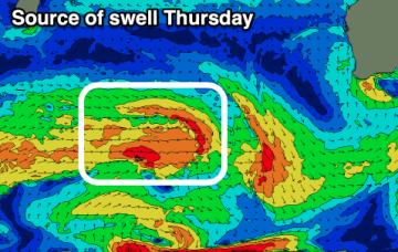
The coming days will offer cleaner conditions with easing surf, ahead of a fun new W/SW swell Thursday. From the weekend things will go onshore and build again.
The window for a clean wave will be trickier to find this week, with a fun weekend ahead.
Winds won't be overly pleasant this week but we should see windows for those on the pulse.
Tomorrow morning is the pick of the weekend, with plenty of swell for next week.
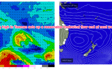
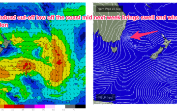
Further ahead and GFS is suggesting a robust high in the Tasman with a trade flow supplying some small surf for the CQ region developing next weekend with another, stronger high moving at Tasmanian latitudes suggesting another SE surge and potential swell from the eastern quadrant.
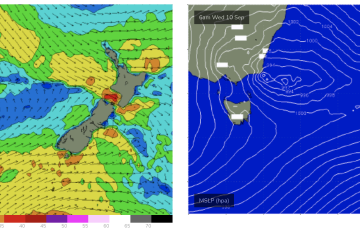
The weekend will be a write-off, with large, improving surf through early next week.
High pressure sits in the NE Tasman for a couple of days early next week- holding a N’ly wind flow through Mon and Tues with minor NE windswell offers some rideable surf.
We’ll see some waves for Fathers Day. Nothing exceptional or inspiring but winds should lay down with light breezes all day, tending NE in the a’noon so workable conditions for most of the day, perhaps requiring a good backbench in the a’noon.