Very slow period ahead
Monday, 5 February 2024
Very slow period ahead
Monday, 5 February 2024
There's nothing of note at all for the coming fortnight.
There's nothing of note at all for the coming fortnight.
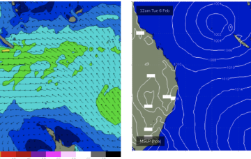
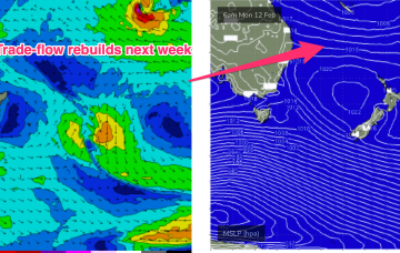
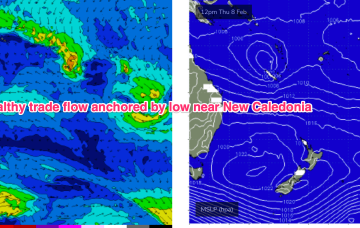
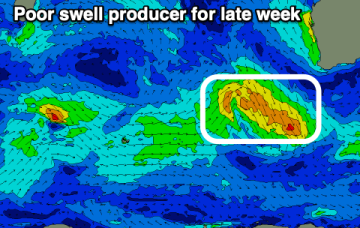
A semi-stationary area of low pressure in the Coral Sea is anchoring a broad trade-wind flow with an extended tradeswell event ahead.
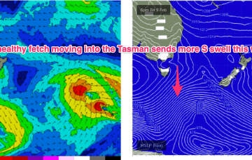
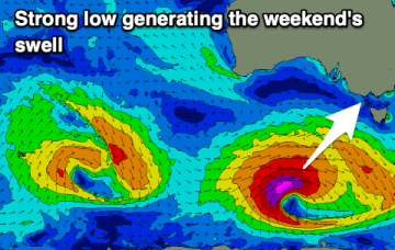
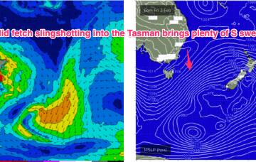
To the south, a severe gale to storm force fetch off the ice shelf from a retrograding low under the South Island sends a rare S/SE groundswell up the Pipe, with another strong front/low late this week into the weekend expected to generate another pulse of S’ly groundswell late this week.
After a great run of surf, the coming outlook is far from a soft landing.
A semi-stationary area of low pressure in the Coral Sea is anchoring a broad trade-wind flow with an extended tradeswell event ahead.
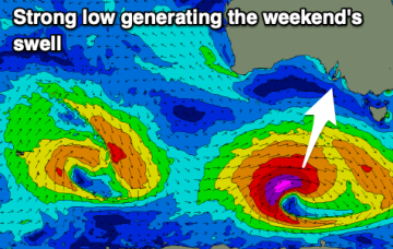
To the south, a severe gale to storm force fetch off the ice shelf from a retrograding low under the South Island sends a rare S/SE groundswell up the Pipe, with another strong front/low late this week into the weekend expected to generate another pulse of S’ly groundswell over the weekend.
There's nothing of note this week thanks to generally average local winds. A strong swell is due on the weekend with decent winds.
The low sits semi-stationary new New Caledonia from today, anchoring a tradewinf flow in the Coral Sea that will provide an extended period of fun waves for CQ, especially spots open to swells through the Breaksea Spit- Capricorn Channel swell window.
A deep low with strong gales currently tracking in a NE direction SE of Tasmania justifies a slight upgrade in size for this weekend at S exposed breaks.
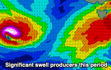
It's a very dynamic couple of days with strong pulses of swell and varying winds.