Good fun swell over the weekend, larger swell Monday afternoon
Friday, 14 August 2015

Good fun swell over the weekend, larger swell Monday afternoon
Friday, 14 August 2015
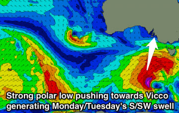
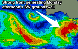
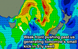
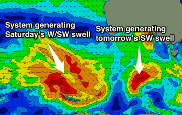
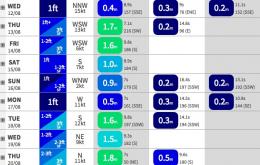
Good building W/SW swell Saturday, easing Sunday with a stronger W/SW groundswell Monday morning ahead of a large SW swell into the afternoon, easing from the S/SW and solid Tuesday morning.