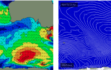
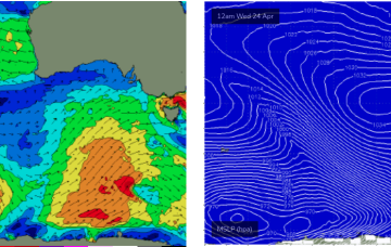
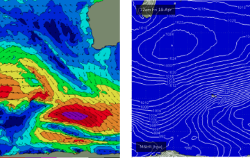
Moderate pulses from the S with a mostly offshore flow
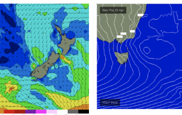
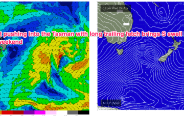
Stronger S swell on offer for Thurs as a trailing fetch slingshots into the Tasman on an already active sea state.
A strong winteresque frontal progression will deliver plenty of waves throughout the state this week.
We’ve got a dominant (1035hPa) high pressure cell sitting just north of the Victorian border, bringing settled conditions and light winds to Central/Southern NSW and strong but easing SE winds in the sub-tropics where a trough of low pressure in the Coral Sea is currently active but dissipating and moving East.
Some frontal activity to the south is poorly positioned and aligned but we will see a stronger frontal intrusion into the Tasman later this week, although not with an accompanying Tasman low as suggested on Friday.
It needs to be reiterated that these kinds of swell patterns are tricky to estimate the precise surf size at specific times of the day...
No new groundswell is due over the weekend so options will be limited to exposed beaches on Saturday.
A strong frontal sequence through the Southern Ocean right now will generate a sequence of new long period swells for Monday and Tuesday.
By Mon morning we should have a complex trough of low pressure NE of K’gari (Fraser Is) with a well developed fetch of strong SE winds feeding into the low and extending well out into the Coral Sea.
Further ahead and things look juicier later next week as a strong cold front sweeps in and conjoins with an area of low pressure exiting the Gippsland coast.
We've got plenty of surf lining up for next week though we have a few days of tricky winds to contend with.