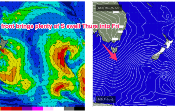
Stacks of swell, just gotta work around the wind
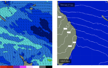
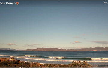
Easing surf is expected over the weekend with light northerly winds keeping surface conditions clean both days.
Friday’s still looking a treat at Victor, thanks to a brand new swell originating from another polar low developing south of the continent over the last day or so.
A monster high (1037hPa) moves into the Bight tomorrow and slowly weakens as it enters the Tasman on the weekend, bringing SE winds into the Coral Sea and holding a small signal of SE-E/SE swell that will hold just rideable surf.
Windy S swells continue into Wed as another major high well south of the Bight shifts E and a series of fronts sweeps across the lower Tasman.
Very nice conditions are expected on all coasts this weekend with light variable winds and weak sea breezes both days.
A weakening trough of low pressure near New Caledonia is seeing easing E swells across the sub-tropics.
Friday looks solid as a range of mid period and longer period S swell trains generated by the proximate and deep fetches make landfall.
Today’s solid swell will hold through early Tuesday morning before easing during the day and continuing its downward trend into Wednesday.
The first cold front will then cross the region around 10pm Tuesday night (give or take) with a vigorous SW change.
The first front is due to push through mid afternoon on Tuesday, ahead of it we’ll see freshening NW winds...