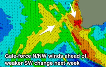
Large windy weekend, easing and improving next week
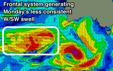
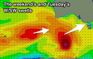
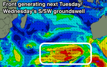
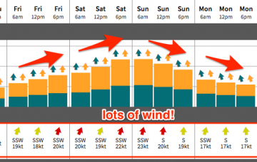
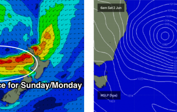
The general swell trend should remain very large out of the south into Saturday morning, at a similar size seen this afternoon.
New pulse of SW groundswell building through tomorrow, easing Sunday with generally favourable winds, and then clean Monday morning before winds go onshore with a vigorous approaching front Tuesday.
Great waves the whole period for the South Coast with a window of fun swell and light winds tomorrow afternoon on the Mid and better swell Monday.
Building long-period W/SW groundswell tomorrow, easing Sunday with light favourable winds. Fun new W/SW swell for Tuesday with possibly variable winds, cleaner and easing on Wednesday with N/NE offshores.
Easing S/SW groundswells through tomorrow and Saturday with a weak S/SW swell Sunday/Monday and better long-period S/SW groundswell later Tuesday, peaking Wednesday morning. Sizey mid-period swells possible from later next week.
Easing S/SW groundswells through tomorrow and Saturday with a weak S/SW swell Sunday/Monday and better long-period S/SW groundswell Tuesday, easing slowly Wednesday. Sizey mid-period swells possible from later next week.
A Tasman Low will form overnight in the central Tasman Sea, and a series of secondary lows and surface fronts wrapping around its western flank will maintain gale force S’ly winds parallel to the NSW Coast for several days.
The synoptics look complex, but in reality the short term period has a relatively straightforward surf outlook. Big and windy from the south.
Average increase in S windswell tomorrow, fading Friday with a good SE swell building Saturday and better, larger E/NE swell for Sunday through Tuesday.
Building W/SW swell with onshore winds tomorrow, cleaner and easing Friday. New inconsistent W/SW groundswell building Saturday, easing Sunday with favourable winds.