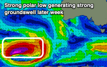
A few swells sources ahead as cut-off low approaches the Island
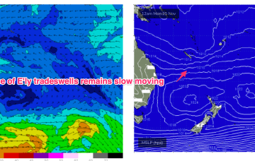
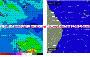
E’ly winds feeding into the cut-off low are aimed directly at NETas and will produce sizier swells into Fri.
As a result, we’re looking at small NE windswells for temperate NSW, with workable trade swells for the sub-tropics and a marginal amount of that swell filtering down to temperate regions.
The coming period offers windows of fun surf between slightly flukey and dicey winds.
As a result, we’re looking at small NE windswells for temperate NSW, with trade swells for the sub-tropics and a marginal amount of that swell filtering down to temperate regions.
Tomorrow is the pick ahead of troughy weather and dicey winds.
The South West will do best over the weekend with a large new swell due next week with favourable winds.
A broad but weak E'ly tradewind fetch occupies the Coral Sea, producing some workable E'ly swell.
Expect some revisions on Mon but at this stage we should see a developing E-E/NE flow into the trough, aimed up at NETas, possibly as early as Wed.
The coming period is a little dicey for the South Coast with tiny swells inside the gulf so get in today and tomorrow if you can.
A broad but weak E'ly tradewind fetch occupies the Coral Sea, producing some workable E'ly swell.