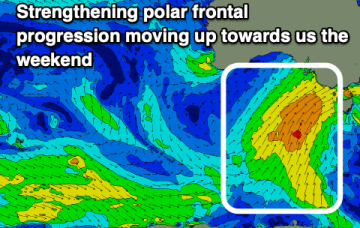
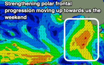
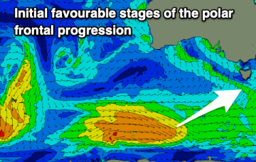
Wintry cold fronts with S swell pulses from Mon
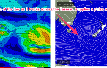
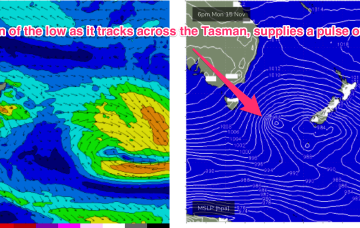
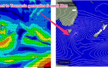
The next cold front is tied to a complex, mid-latitude low and sees gales sweeping up from the Southern Ocean adjacent to Tasmania on Monday.
Winds will be from the Western quadrant all weekend and the surf is likely to be ironed flat in SEQLD, with the small S swell trains on offer not likely to make landfall north of the border, save a few small peaks at the mouth of the Tweed.
There's lots of activity on the cards this period but winds are flukey and finding a clean wave will be tricky.
Sunday gets a little upgrade, in energy at least. A coast hugging fetch of gales whips past the NSW South Coast overnight Sat, into the early hours of Sun, before the low moves away rapidly during the day.
A couple of small, clean days to pick the eyes out of but generally average ahead of some better swells Monday week.
There's nothing to recommend for the weekend with poor, onshore surf. Larger waves are due into Monday but winds will remain a problem, improving from Tuesday.
A cold, wet and windy outlook this period, large Monday but the quality will be lacking.
The low forming just to the E of Tasmania overnight sees fresh SW to S’ly winds develop through the day, with a quick rise in S swell expected through the day.
No great pressure gradient squeezes are on offer at present with only flabby high pressure drifting NE in the Tasman sea. Weak swells and wind changes continue.
The coming days will be poor but we should see more options opening up from Sunday.