Active outlook continues
Monday, 5 February 2024
Active outlook continues
Monday, 5 February 2024
The coming period remains more than active with swells from all directions.
The coming period remains more than active with swells from all directions.
There's nothing of note at all for the coming fortnight.
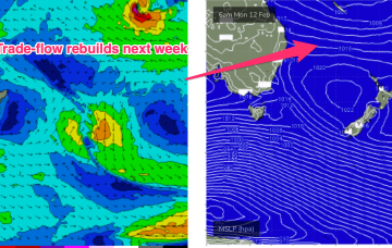
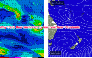
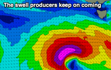
A semi-stationary area of low pressure in the Coral Sea is anchoring a broad trade-wind flow with an extended tradeswell event ahead.
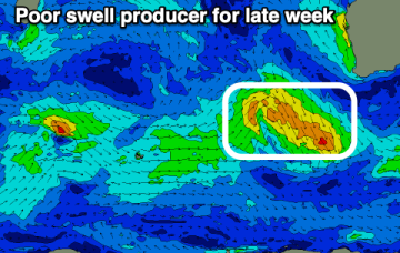
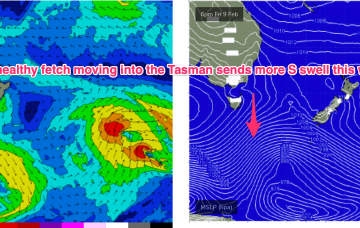
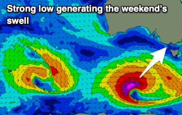
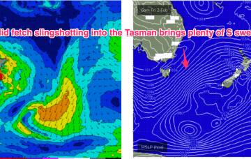
To the south, a severe gale to storm force fetch off the ice shelf from a retrograding low under the South Island sends a rare S/SE groundswell up the Pipe, with another strong front/low late this week into the weekend expected to generate another pulse of S’ly groundswell late this week.
After a great run of surf, the coming outlook is far from a soft landing.
A semi-stationary area of low pressure in the Coral Sea is anchoring a broad trade-wind flow with an extended tradeswell event ahead.
To the south, a severe gale to storm force fetch off the ice shelf from a retrograding low under the South Island sends a rare S/SE groundswell up the Pipe, with another strong front/low late this week into the weekend expected to generate another pulse of S’ly groundswell over the weekend.
There's nothing of note this week thanks to generally average local winds. A strong swell is due on the weekend with decent winds.
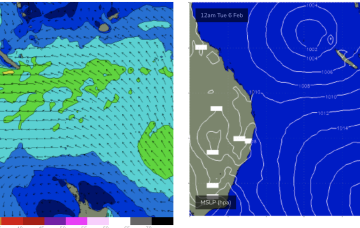
The low sits semi-stationary new New Caledonia from today, anchoring a tradewinf flow in the Coral Sea that will provide an extended period of fun waves for CQ, especially spots open to swells through the Breaksea Spit- Capricorn Channel swell window.
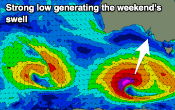
A deep low with strong gales currently tracking in a NE direction SE of Tasmania justifies a slight upgrade in size for this weekend at S exposed breaks.