Improved wind outlook for tomorrow
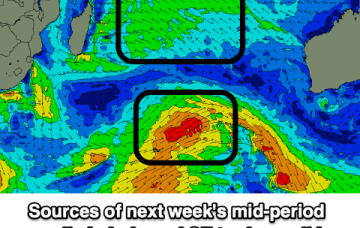
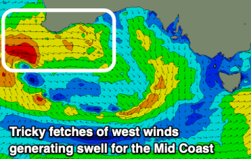
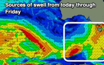
We've got better local winds forecast for tomorrow with a good sized S/SW swell, easing Friday. The weekend looks poor while next week will be very slow.
This week looks the most active for swell across all regions.
Thursday is where things really get active. A deep Tasman Low will have been forming from Wednesday onwards, displaying a broad belt of S/SW winds that’ the entire length of the eastern seaboard, from the southern tip of Tasmania up to about Mackay.
The main synoptic activity this week will be related to an amplifying node of the Long Wave Trough which is expected to slide through the Tasman Sea before parking itself across New Zealand longitudes later in the week. We’ll see a prolonged round of large to very large swell as a result.
The coming period will be dominated by south and then south-east swell energy.
A stalling low east of us from mid-late week will bring a constant southerly wind and SE swell through the weekend/early next week.
The current XL stormy swell will ease over the coming days as winds slowly improve, with tricky winds and fun swell from later week.
We've got a tricky west swell for the Mid Coast followed by S/SW swell energy and workable but not perfect winds for the South Coast.
Winds will be the main issue this week, with a couple of swell generating systems due to arrive with average conditions. The weekend and early next week are fluid as well.
I’m expecting a small, slow start on Saturday with residual energy from today, however by lunchtime...