Make the most of Tuesday
Monday, 4 June 2018
Make the most of Tuesday
Monday, 4 June 2018
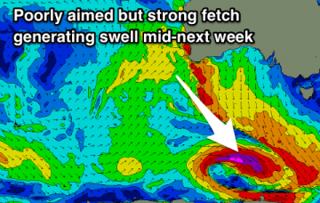
Easing levels of E'ly swell over the coming days, with a poorly aligned N'ly windswell late week.
Easing levels of E'ly swell over the coming days, with a poorly aligned N'ly windswell late week.
The source of our current swell weakened considerably over the last 24 hours so we’re looking at a steady decreasing trend through Tuesday and into Wednesday morning.
Nothing of significance but clean tiny waves for beginners.
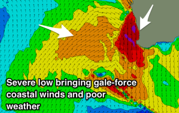
Poor conditions over the coming days with a severe and 'bombing low' due to bring gale-force onshore winds and stormy swells, possibly clean early Thursday and Friday mornings in Perth and Mandurah before going back onshore on the weekend.
Easing W/SW groundswell tomorrow, cleanest on the Mid and improving down South. Small and fading Wednesday down South with a new acute W'ly swell building Friday ahead of a larger W/SW groundswell Saturday with light winds.
New W/SW swell but with onshore winds tomorrow, clean and easing on the beaches Wednesday. Possible small W'ly swell Friday but much better Saturday with great winds for the Surf Coast.
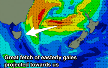
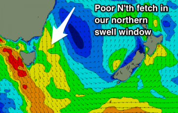
Lots of good days of waves with a building SE swell tomorrow, stronger E/NE pulse for Sunday, holding Monday and easing from Tuesday with a N/NE windswell late week.
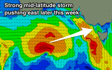
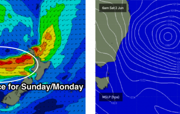
The general swell trend should remain very large from the south throughout Saturday.
Small flukey swells over the coming forecast period with decent winds.
The general swell trend should remain very large out of the south into Saturday morning, at a similar size seen this afternoon.