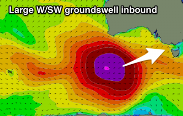
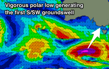
Upgrade in S/SW swell over the coming days
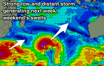
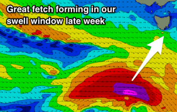
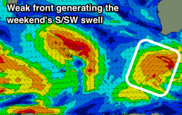
Easing surf ahead of a strong new S/SW groundswell late week, and further activity from Sunday but with average winds.
Flukey S'ly swell pulses, biggest over the next coule of days with better swells from mid-late next week.
A good large long-period S/SW groundswell over the coming days and then down into the weekend and early next week. Swell on the cards again later in the period.
This morning is the pick of the forecast period as we’ll see inconsistent though building S’ly swell and early light winds. More details in the Forecaster Notes.
Nothing really of note this week besides a flukey NNE swell. Better southerly swell prospects from the weekend as the LWT moves into position.
Around the middle of the day (or possibly earlier) the leading edge of a long range, long period southerly swell will push up into the region, generated by an intense polar low sliding well south of SA, Victoria and Tasmania on Thursday.
Plenty of swell on the cards with the LWT coming to play from the weekend.
An end to the large windy winter swells with improving conditions and dropping swells, slower but clean into the weekend and best at swell magnets.
Persistent winds from the west with a large and powerful long-period W/SW groundswell filling in, easing into the end of the week.
One major swell this week with great winds for selected spots as it builds, favourable as it slowly eases as well.