Strong, good swell early next week
Friday, 1 December 2023
Strong, good swell early next week
Friday, 1 December 2023
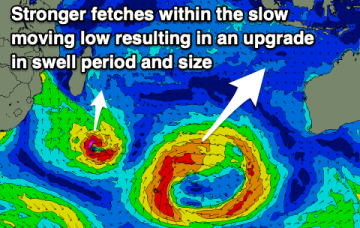
A poor weekend is expected with a large, prolonged swell for early to mid next week.
A poor weekend is expected with a large, prolonged swell for early to mid next week.
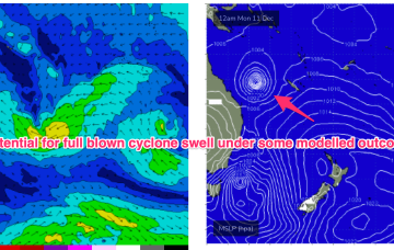
Further ahead and some weather model runs are starting to look pretty damn juicy with respect to a developing TC in the South Pacific moving into the Coral Sea next week. Still very early days but a full blown cyclone swell is now a definite possibility, possibly as early as late next week and into the weekend.
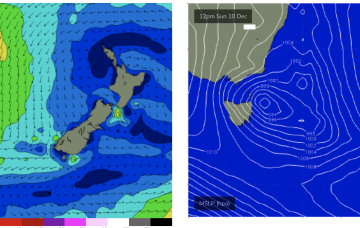
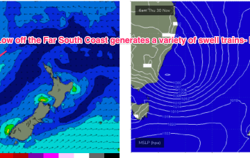
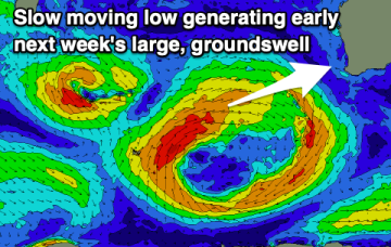
No great change to the weekend f/cast. Low pressure has moved off the coast and is slow moving, with a broad fetch of strong E’ly winds on the southern flank of the low supplying plenty of E’ly swell to NE Tasmania.
Further ahead and some weather model runs are starting to look pretty damn juicy with respect to a developing TC in the South Pacific moving into the Coral Sea later next week. Still very early days but a full blown cyclone swell is now a definite possibility, possibly as early as next weekend and into the week 9/12
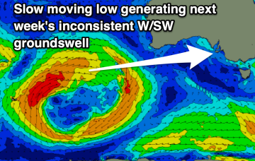
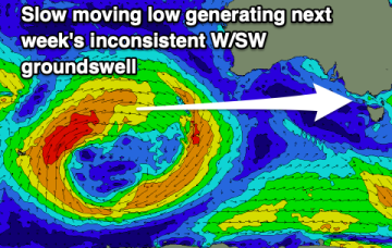
The weekend will be poor while next week holds more promises with a fun, prolonged W/SW swell event.
Low pressure has moved off the coast and is slow moving, with a broad fetch of strong E’ly winds on the southern flank of the low supplying plenty of E-E/SE swell to Southern NSW (and Tasmania).
The coming weekend looks poor wind and swell wise, while into next week some fun, but inconsistent westerly swell is due with workable winds.
Slight upgrade in next week's fun SW swell.
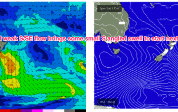
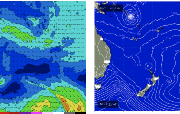
A new high pressure system moves E of Tasmania next week and there is some suggestion we’ll see a SE surge up the coast Tues, with a developing trade-wind flow through the rest of next week. Models are still divergent about the strength of the tradewinds so we’ll keep our jets cooled at far as size goes for now.
A dynamic weather event is underway as a complex inland low approaches the Far South Coast of NSW, expected to enter the Tasman Sea tomorrow. A moist NE-E/NE infeed into the low is generating plenty of rain (heaviest falls on the South Coast) and building swells from the same direction, focussed on NETas. We’ll see large surf develop across NETas as the low moves offshore tomorrow.