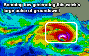
'Bombing low' to bring large spike of swell
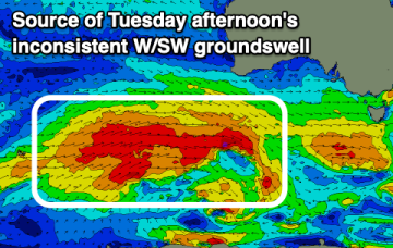
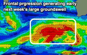
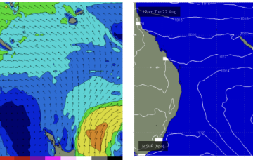
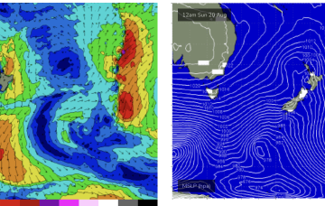
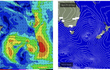
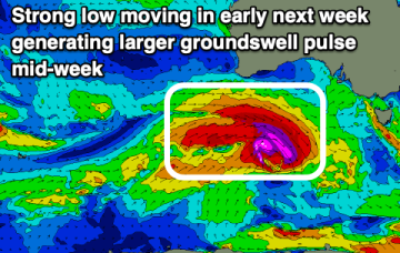
We've got a rapidly deepening low pressure system under the country, bringing a large, short-lived spike of groundswell.
Generally clean conditions the whole period with fun pulses of west swell.
The coming period remains tricky for the South West with no true offshore pattern but windows of decent conditions.
We should see an end to the flat spell by Tues next week, with a high pressure ridge building up the QLD coast and Tradewinds forming a broad fetch through the Southern/Central Coral Sea.
No great change to the weekend outlook. Not much swell on offer unfortunately.
Sunday looks better, for size at least. The head of the fetch reaches almost to New Caledonia and this typically aids S swell penetration into SEQLD.
The coming period will be favourable for the South Coast with back to back swells with small windows on the Mid Coast.
Minor tweaks to the weekend f/cast with the front and associated low just looking a little more organised and not so disjointed. It’s not going to add much materially to wave heights, we’re still looking at pulsey S swell to 3-4ft through Sat with a mid/late morning peak offering up some bigger 3-5ft surf at S facing beaches.
There's building swell energy in both size and period due through next week following a spike in size tomorrow.
Large surf today, easing slowly through tomorrow with a slightly smaller swell for next week.