Small mix of fun swells, stronger Sunday
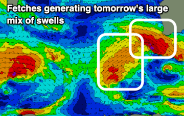
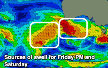
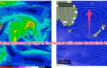
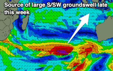
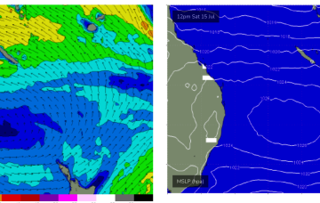
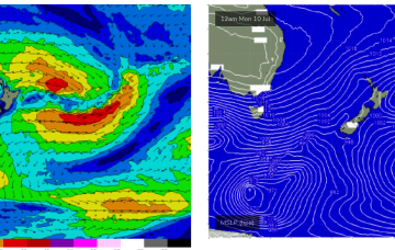
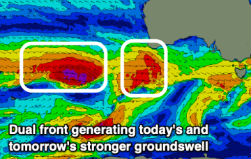
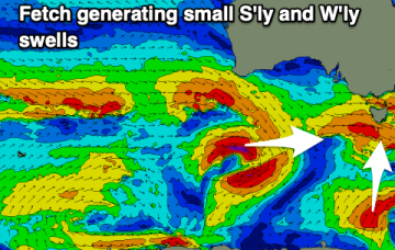
A mix of S and W/SW swells are due over the coming days with a better pulse of W/SW swell for Sunday.
There might be a couple of better windows opening up around the South West over the coming days. Perth and Mandurah should be fun.
A strong new W/SW groundswell is due late today, with the most size seen tomorrow morning but with strong winds. Follow up swells with better winds look more appealing.
Cold fronts have passed through the Tasman and the high pressure will now exert a blocking effect, steering fronts well away from the swell window or ensuring a zonal (W-E) flow through the end of the week and into the weekend.
The good times keep on keeping on. Tomorrow's swell looks the least consistent of the bunch.
The surf will ease ahead of a new, large S/SW groundswell later this week, with a follow up next week.
A mix of W/SW and S swells for the coming days, with building W/SW energy from the weekend.
Tiny/flat surf look to build from Thurs as a new high pressure ridge builds up the QLD Coast. The high moves into the Tasman at roughly sub-tropical latitudes, with a reasonable ridge up the QLD Coast and some small, peaky swell developing likely into the 1-2ft range through Thurs.
Another week begins with a classic winter El Niño pattern. High pressure over the continent with a W’ly flow being enhanced by a series of mobile fronts and parent lows, with tiny amounts of S swell wrap. Nothing of any size its expected due to the zonal and mobile nature of the fetches so you’ll need to find a swell magnet to find anything rideable.
Large swells with persistent onshore winds all week, easing into the weekend with a window of cleaner conditions.