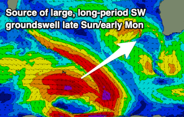
Best for the South Coast, especially from the weekend
Monday, 8 September 2025
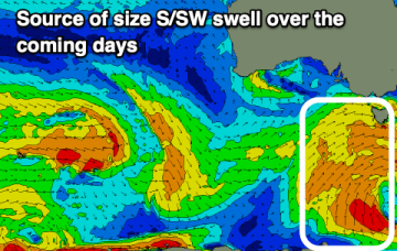
Best for the South Coast, especially from the weekend
Monday, 8 September 2025
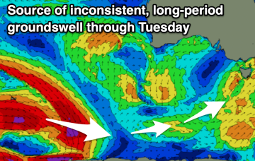
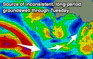
The window for a clean wave will be trickier to find this week, with a fun weekend ahead.