Fun surf tomorrow, and then on the weekend
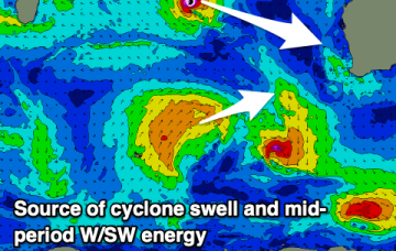
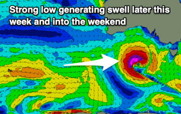
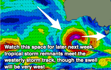
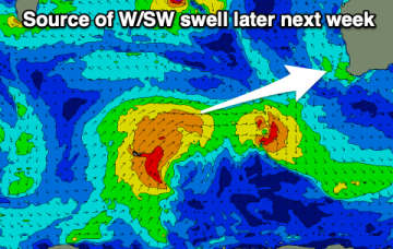
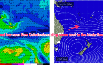
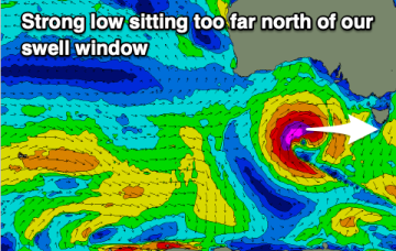
The coming period is a bit hit and miss with a strong swell producer sitting too far north of our swell window.
Generally small to moderate sized swells will continue with varying winds, though a flukey W/NW cyclone swell should also be in the mix.
A small reinforcing swell is due today and tomorrow with funky winds, cleaner but bottoming out Wed/Thu. A large but onshore swell is due Friday, better on the weekend.
Clean conditions with a fun, easing swell is due over the coming days ahead of some larger, windy swell from late week.
The coming days look generally small with a couple of clean, morning windows.
E’ly winds continue into next week, through this period and in fact most of next week we’ll continue to see pulsey E’ly swells coming off the deep E’ly fetch.
This afternoon's groundswell will ease into the weekend, with some small swell for early next week. Later next week looks a bit better.
A long, broad E’ly tradewind fetch extends from the Coral Sea into the South Pacific with the tail of the fetch in Tahitian longitudes. To the south a complex low and front is expected to pass under the state over the weekend.
High pressure belt remains strong with cells lined up to enter the Tasman. A monsoonal low in the Gulf of Carpenteria is generating a long cloud band down the east coast. A long, broad E’ly tradewind fetch extends from the Coral Sea into the South Pacific with the tail of the fetch in Tahitian longitudes.