Make the most of the current and coming swell
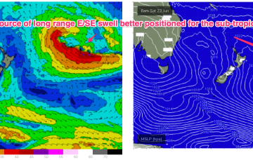
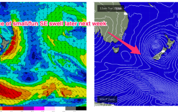
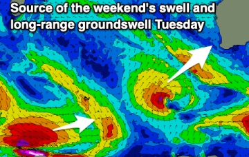
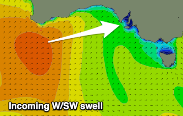
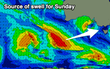
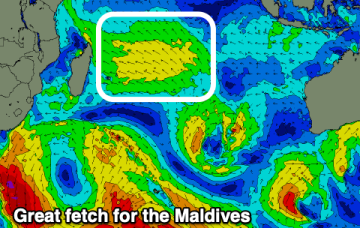
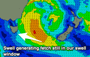
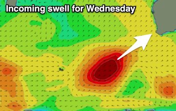
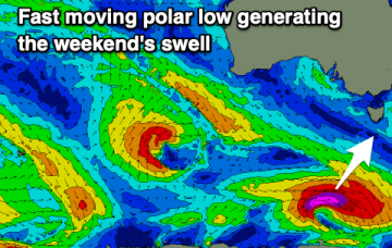
Next week looks very slow so make the most of the current E/SE swell and new SW swell spike for the weekend.
995 hPa low still sitting in the Central Tasman, but the supporting high pressure cell has slipped in underneath the low and as a result we’re seeing a slowly diminishing fetch and easing pressure gradients both in the Tasman and along the coastal fringe.
Make the most of today before the size eases over the coming days ahead of the next episode of large, windy but weaker surf on the weekend.
Tomorrow will be very dynamic as a mid-latitude moves across us bringing a wide variation of winds (improving) along with some new west swell.
The coming days look poor but we should see a fun new swell with clean conditions on Sunday, slow again into the start of next week.
Smaller but fun swells for Indonesia, lots of action for the Maldives.
The Tasman Low to our east will have longevity, bringing plenty more E/SE swell energy with funky winds.
Today's swell will ease with an onshore change tomorrow, better again Wednesday with a large new swell.
The coming days look slow ahead of a better W/SW swell later week.