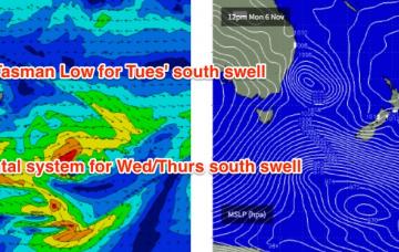
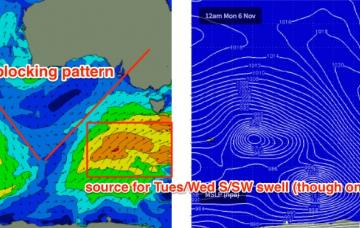
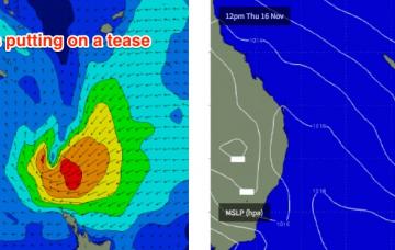
Fun weekend for the beachies; dynamic potential for next week
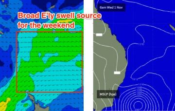
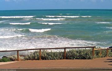
The only real swell source for the weekend will be the existing E’ly swell.
Sunday’s NE airstream will be related to a developing trough of Southern NSW, that will form a Tasman Low by Monday afternoon.
You’ll have to make the most of the dawn patrol down south on Thursday.
A new groundswell is expected to build across the coast, generated by an intense storm well SW of Western Australia over the weekend and earlier this week.
Strong S’ly swells will push across Northern NSW on Thursday, originating from the strongest part of the current Tasman Low.
The expected E/NE swell is still on track, and should arrive through tomorrow before showing strongly through Friday.
A new long period swell is due to arrive overnight Wednesday.
If anything, the local wind forecast for tomorrow looks a smidge better.
We’ve got a very complex week ahead, with around six individual swell sources - one out of the north, two out of the east and three out of the south.
There’s no real change to the notes issued Friday, except a little more fine tuning on size and timing for each incoming swell this week.