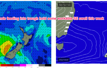
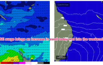
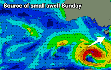
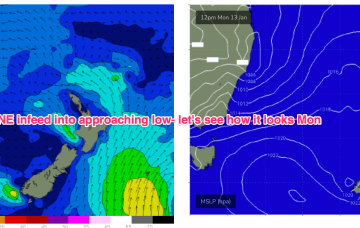
Average period of winds with varying swell pulses
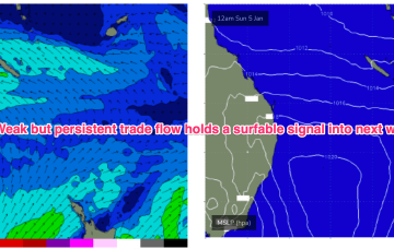
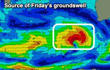
The coming period is average with mostly dicey winds though a couple of decent swells.
The current synoptic situation has a Groundhog Day feel to it, with another very weak high pressure cell in the Tasman (1019hPa), directing a mod N’ly flow along the temperate NSW coastline, with a weak Tradewind flow in the Coral Sea
Small swells with favourable winds for the beaches will pad out this period. A stronger swell is due on the weekend.
With high pressure moving NE into the Tasman we’ll see winds increase as a SE surge builds up the Fraser/Burnett coast.
The coming period isn't great with tomorrow morning likely being the pick of it.
With high pressure moving NE into the Tasman we’ll see winds from the N freshen through Sat reaching mod/fresh paces in the a’noon. That should generate some workable NE windswell for tomorrow.
Compared to the last few weeks the coming period is very slow but there are a couple of fun mornings expected.
Further ahead and we have a dynamic outlook on the cards. An inland low and trough - a hybrid monsoonal feature- looks to approach the NSW coast, with a strengthening NE infeed into the system.
Make the most of the current swell and favourable weekend winds before things go quiet from next week.