Stacks of E'ly swell; problematic winds in the south, better through SE Qld
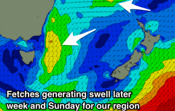
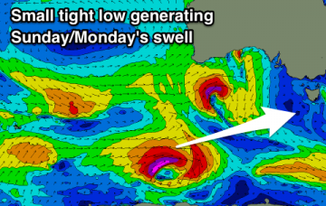
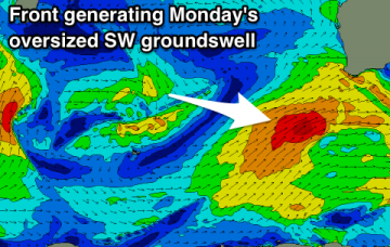
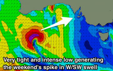
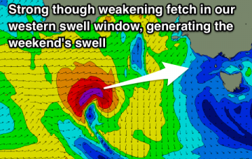
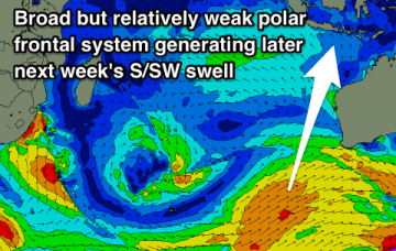
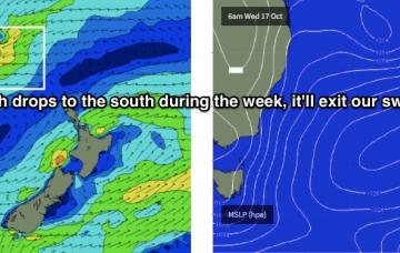
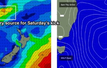
For the next few days, we can divide the forecast into two distinct parts: swell and wind.
Building NE swell tomorrow before fading slowly from Friday with a reinforcing pulse for the weekend.
Water temps are reportedly down 1-2 degrees since the start of the week, and I wouldn’t be surprised if it drops a little more as we head towards the weekend. So you may need to being back the winter rubber!
Tiny swell for tomorrow, easing into the weekend with a new swell kicking later Sunday and peaking Monday morning.
Poor conditions over the coming days with building and strengthening swells with onshore winds. Large and improving next week.
Good pulses of W/SW swell with generally favourable winds for both the Mid and South Coasts through most of the period.
A better W/SW groundswell is due tomorrow, easing with more options into Friday while we've got a fun swell with favourable winds for the weekend.
A couple of swells this week before going quiet next week. Varying winds before the SE-S/SE trades kick back in from the weekend.
A slight lift in swell tomorrow with some better energy from later week as funky winds give back into trades.
In any case, large swells will persist into Tuesday (too big for most coasts) so you’l be better off leaving things until we see an easing in the size department and an abatement of wind speeds later this week throughout SE Qld.