Tricky period of winds and swell
Friday, 12 August 2022
Tricky period of winds and swell
Friday, 12 August 2022
Plenty of swell this weekend with tricky winds, dicier next week as surface troughs and fronts move across us.
Plenty of swell this weekend with tricky winds, dicier next week as surface troughs and fronts move across us.
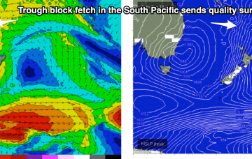
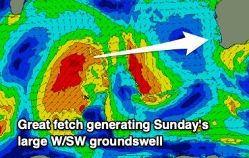
While this is happening a long trough line in the near South Pacific forms and deepens with a wind speeds increasing along a broad front due south of New Caledonia as they feed into the trough. Strong winds to gales feeding into the fetch through Tues-Thurs are expected to generate quality E/NE swell trains for the region.
Fading waves on the Mid Coast with slowly improving conditions, better down South with a sizey new S'ly swell and favourable winds.
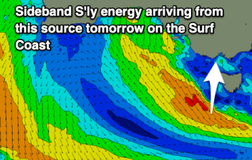
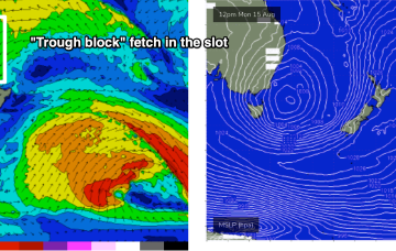
We still have the same building blocks in place for next week but the timing has been pushed back and the mix has been altered as E swell dominates from the “trough block” and S swell fades in importance.
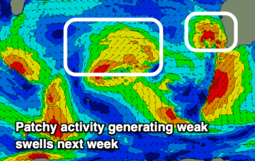
Don't get too excited just yet but there's a bit more activity pegged from later next week into the following week. We'll see how it plays out.
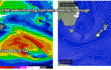
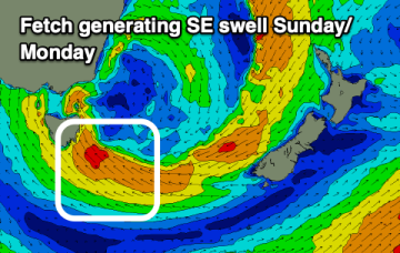
There’s still some model divergence on the position of the low on Sun, and a fetch of strong winds on the southern flank of the low. Either way we’ll see large storm surf from the SE to ESE develop, in conjunction with building NE swell.
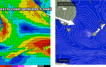
The multiple fetches coming off a Tasman low near New Zealand anchored by a high just east of Tasmania are now starting to wane. Current ASCAT (satellite windspeed) passes show a weakening fetch of SE winds in the Central/Northern Tasman and a thin fetch of strong winds out of Cook Strait. That will lead to a slow easing trend through tomorrow, accelerating into Fri and the start of the week-end.
Tiny to flat surf ahead of some building S swell Saturday, stormy and out of the SE on Sunday.
Smaller but cleaner surf tomorrow, becoming windy again Friday with a small reinforcing swell. Larger surf on the weekend with windows.
The multiple fetches coming off a Tasman low near New Zealand anchored by a high just east of Tasmania are now starting to wane. Current ASCAT (satellite windspeed) passes show a weakening fetch of SE winds in the Central/Northern Tasman and a thin fetch of strong winds out of Cook Strait. That will lead to a slow easing trend through tomorrow, accelerating into Fri and the start of the week-end.