Great run of waves for exposed beaches

South Australian Forecast (issued Friday 19th September)
Best Days: Every morning down South over the coming period, Mid Coast Saturday afternoon, Sunday morning and Tuesday morning
Recap
The Mid Coast offered fun waves early yesterday with an easing W/SW groundswell to 1-1.5ft with the odd 2ft bomb with light offshores, while the South Coast also saw unexpected morning offshore winds cleaning up a fun medium sized S/SW swell.
Today both swells have dropped away with great conditions down South with a light offshore and perfect conditions for beginners on the Mid.
This weekend (Sep 20 - 21)
Tomorrow will start out small across the South Coast but fun at exposed beaches with offshore NE winds. A new inconsistent SW groundswell is due to fill in through the day though and build to 3ft at Middleton with 3-5ft sets at Waits while the Mid should pulse to 1-1.5ft during the afternoon. Winds will unfortunately go SE down South, but the Mid should remain clean all day.
A peak in swell is due overnight, with a slight drop into Sunday but winds will be great again with offshore N-NE winds ahead of SE sea breezes.
Next week onwards (Sep 22 onwards)
Monday morning is still looking great at exposed beaches down South with an easing swell from the weekend to 2ft at Middleton and 3ft+ at Waits under fresh but easing N/NE tending E/NE winds. Get in early for the biggest and best waves though!
A renewal of very inconsistent long-range W/SW groundswell is due Tuesday morning across both coasts, generated in the Southern Indian Ocean and arriving very late Monday.
No appreciable size is likely across both coasts Monday but Tuesday should see infrequent 1-1.5ft waves on the Mid, with 2ft+ sets at Middleton and 3ft to occasionally 4ft waves at Waits and Parsons.
Winds will be best for the South Coast but still favourable for the Mid with a fresh and gusty but easing N/NE tending E'ly breeze.
 Another long-range swell should keep the surf in the 2ft range at Middleton and 3ft to occasionally 4ft at Waits Wednesday morning before dipping into the afternoon, as the Mid eases from 1ft. Winds will play out similarly to Tuesday with a fresh and gusty N/NE tending E/NE breeze.
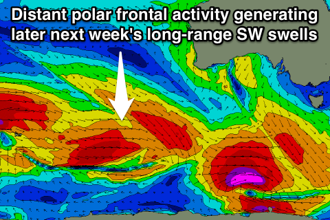
Into the end of the week we'll see some slightly bigger long-range SW groundswell energy impacting the state but this will be again from our distant swell window to the south-west of WA. Winds should remain good into Thursday but a shallow change on Friday is likely to be followed by persistent SE winds into the following weekend and start of the next week. More on this Monday though. Have a great weekend!