Sand Banks


southey wrote:Vic lb your proving yourself the right royal wanker . Nobody likes a self righteous tosser . And it doesn't matter where u live your still a tosser . In the times I enjoyed that region , people didn't tolerate " tossers " like u ...
People just reminded you to be a little more discreet , and you go and shit in their direction . No wonder I don't frequent the water there anymore , because even " new locals " like you are dickheads . Way to shit in your own nest . All I hope is that some " Ol' school " no nonsense guys read this work out who you are and fade you on your rice bubble at every opportunity at all these low key spots you keep talking up as " your playground " , your not impressing any one , loud mouths aren't legends . Best you keep your act local .
PS , I have a fair idea who you are , and if I'm wrong then pretty sure goofy does .
thumbs up!


Nick Bone wrote:A one Mr. Alex Zadnik may have got wave of the day during one of the sessions.
Yeah, we heard about it alright, sounds like it was pumping!


Thanks for pumping up my tyres Nick! From memory you got a pretty good one on the Sunday. I was pretty happy with my score on the Saturday.
I'd say you're on the money with the orientation of Gunna versus Portsea impacting on bank quality, along with the overall shape of the beach. Gunna is a little more curved and broken up with rock sections that probably facilitates the formation of gutters more readily, and the orientation (more west facing) probably means SW swells don't hit quite as straight on.. Portsea's beach is pretty straight from LB's through to Sphinx, plus faces due SW for the most part. Also different offshore set ups, which probably contributes as well.
All in all a number of factors probably play a role.
Might see you back out there this weekend...
Nick Bone wrote:thermalben wrote:Nick Bone wrote:But now it seems Portsea is stuck on groundhog day with sandbars parallel to shore with the occasionallllllllll corner.
Six weeks ago Portsea had unreal banks, that were perfectly visible on our surfcam (see image below). Was like this for about a week if I recall correctly.
Yeah Ben, it got a good right. But it lasted about a week before getting real straight again. Not to mention how long that took to take shape haha.
After two weeks of howling onshores and macking swells, there were some good waves around the peninsula too this weekend just past. A one Mr. Alex Zadnik may have got wave of the day during one of the sessions.


No one else thinks the gradient out to deeper waters has much to do with it? I haven't looked any closer than the 20m contours and google sattelite images, but it looks deeper out off Gunnas. As it does at wooly; not sure about the others but (liptrap, etc)


Another possibility is the contemptible channel dredging at The Rip several years ago. This certainly would have affected tidal currents in the area, so I wonder if the effect has extended as far as Portsea Back Beach? It certainly screwed things inside the Bay. As an aside, I wonder if Quarantine was affected by the dredging?


Yeah, and I hear that because of the dredging, when you have large storm swell events, erosion on the front beach at Portsea has increased. More energy entering in through the bay.


Yo Craig, not really more entering thru the heads. just a deeper funnel inside the bay pointed at Portsea front beach. The digging was more inside the heads.
Yo Crip, Corsair (as it's called over the other side) didn't change, same wave.


Its a good thing the WOTD from yesterday isn't on the Mornington Peninsula coz it wouldn't be a secret and it would be named here


Yeah, like there are secret spots on the Peninsula!
Ok, there are spots that aren't as well known as Gunna, Rye or Portsea, but naming them or even giving them a show on WOTD is not really going to change things.
Let's face it, most of 'em are a bit of a walk in to check it out and most are fickle. Unreal when they turn on, but you have to know when, what tides, what swell, what wind and how to get in there. Don't get them right and you'd wonder what the fuss was about.


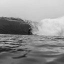
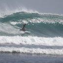
Photo 'C' looks like Woolamai with foots in the background.
Actually I'll go ahead and say 'it is' Wooly.


A very general question which probably has alot viable answers but im just wondering how sand banks actually form up at beachbreaks? What are some contributing factors that lead to bank development?
Specifically, I live on the Mornington Peninsula and at one end we havr Gunnamatta which gets better quality and more consistent sand banks whereas down the other end at Portsea it struggles to form any decent banks.
Is it to do with the bathymetry from beach to beach? Is it the way the coast faces to swell direction. The Peninsula faces pretty much straight on to predominant swells but Gunna and Portsea are angled differently ever so slightly. Is it to do with the minor rock formations on the shoreline which may direct sand flow?
Any insight on this matter would be muchly appreciated! I understand there probably a definitive answer but i would love to hear any theories etc. on it!
Cheers!!