Fun S/SE groundswell tomorrow, very slow thereafter

Eastern Tasmania Surf Forecast by Craig Brokensha (issued Monday 23rd April)
Best Days: Tuesday, south magnets Wednesday morning
Recap
The swell kicked unexpectedly through Saturday to 3-4ft out of the south, easing back a little yesterday and smaller today.
Today’s Forecaster Notes are brought to you by Rip Curl
This week and weekend (Apr 24 - 27)
Later today we should be seeing some new S/SE groundswell energy impacting the coast, with the swell still due to peak tomorrow morning to a good 3ft across exposed breaks with improving conditions under a N/NW tending NW breeze.
 The swell is expected to ease through the afternoon, back from a smaller 2ft max on the sets Wednesday morning with W/NW winds.
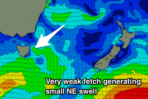
Looking at the activity in the Tasman Sea and it's relatively weak and not really forecast to reach any major strength through this week.
We should see a persistent fetch of E/NE winds aimed through our swell window over the coming days, producing small levels of NE swell from Wednesday through until Sunday, pulsing between 1ft to sometimes 2ft at magnets.
Unfortunately there's nothing else really on the cards for us make the most of tomorrow!