Healthy outlook which favours the Mid Coast
Monday, 7 October 2024
Healthy outlook which favours the Mid Coast
Monday, 7 October 2024
The coming period looks more favourable for the Mid Coast wind wise than the South Coast.
The coming period looks more favourable for the Mid Coast wind wise than the South Coast.
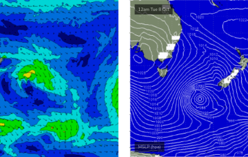
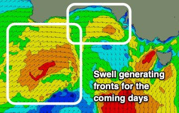
We've got a classic spring setup with passing, swell generating fronts followed quickly by high pressure.
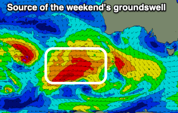
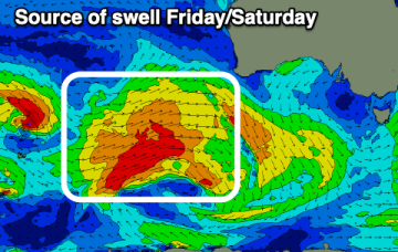
The weekend’s large S/SE swell is still expected to push through, but unfortunately, winds are still looking difficult for many areas.
We’ve got some great waves due this weekend, with light offshore winds both days and only weak sea breeze an outside risk each afternoon.
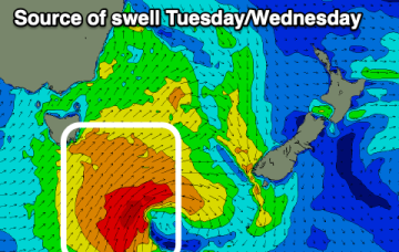
The coming period is promising with great waves on the weekend followed by a good southerly swell mid-next week.
There's not much on the cards for the weekend unless you head to exposed east facing breaks.
Dicey winds will offer limited windows for the weekend, better into next week with a good swell Wednesday.
Mid-latitude frontal activity will bring cool, showery weather and plenty of west swell.
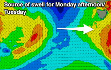
Today and tomorrow are lay days, with some new swell building Sunday, holding Monday.
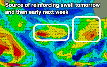
Large S'ly groundswell inbound over the coming days.