Windows opening up for the beaches
Friday, 27 September 2024

Windows opening up for the beaches
Friday, 27 September 2024
After a great run for sheltered spots, this outlook sees the exposed beaches offering a few windows.
After a great run for sheltered spots, this outlook sees the exposed beaches offering a few windows.
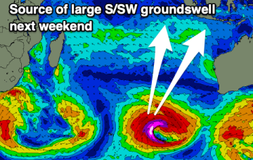
Large swell brewing for next weekend.
As a low sits off the SEQLD Coast over the weekend we’ll see a small signal of E/SE swell develop Sun at exposed spots north the Breaksea spit.
We've got plenty of swell from today through the end of the week but with tricky winds.
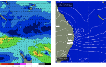
Swells from a deeper fetch associated with the polar low under the front bring longer period S swells on Fri.
Today looks the best for a few days across the South West so make the most of it.
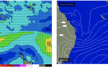
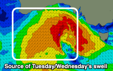
High pressure moves off the South Coast into the Tasman over the weekend with a low pressure system off the SEQLD coast directing a broad fetch of strong wind to near gale S/SE-SE winds through the Northern Tasman. This will produce large SE’ly swells for the sub-tropics with only Points rideable for most of the region.
The Mid Coast will see fun waves tomorrow, switching to the South Coast Friday. Next week looks interesting.
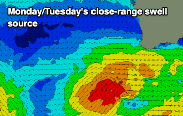
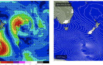
A robust front linked to a deep low is expected to migrate up the southern NSW coast o/night and into the wee hours, with a surface low expected to form off the North Coast as a trough interacts with the front.
A strong southerly change is just arriving, with conditions due to remain poor until Friday.