Improving surf to finish the working week
Wednesday, 20 September 2023

Improving surf to finish the working week
Wednesday, 20 September 2023
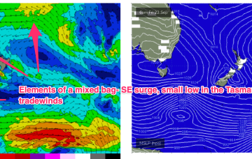
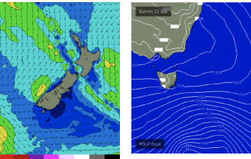
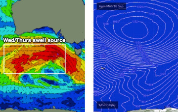
Building swells today will peak overnight and then gradually ease through Thursday, though trailing SW winds behind the front will maintain poor conditions down south.