Average week, but some potential for Thursday and Friday
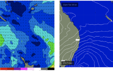
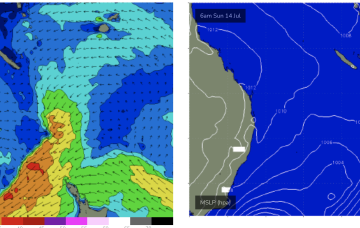
The low responsible for our current local swell is moving outside of our swell window, and so surf size will ease into Tuesday.
A deep low pressure system near Tasmania is directing strong southerly winds across the South Oz coast.
The long term looks more typical for Victoria wind-wise, with an amplifying long wave trough west of the state maintaining moderate to fresh NW winds for much of the week.
The onshore pattern remains established over the weekend with high pressure riding at sub-tropical latitudes and a zone of enhanced storminess riding NE with seas in excess of 25ft later this week.
No swell generating winds in the swell window so we’ll see flat surf for all of this week.
We have a deep low (985hPa) adjacent to Tasmania and another attached low centre further E in the Tasman with the long E’ly infeed into this complex low gyre focussed near the west coast of the North Island aimed up at Tasmania.
We have a deep low (985hPa) adjacent to Tasmania and another attached low centre further E in the Tasman with the long E/NE infeed into this complex low gyre focussed near the west coast of the North Island and slowly sliding out of the swell window.
Besides tomorrow morning the outlook is poor for the coming period.
The trough block scenario is reaching maximum strength but moving southwards as it does so. We’ll see a slight kick in size tomorrow for CQ then waves steadily easing over the rest of the weekend, going back to tiny and then flat next week as a cold outbreak brings W’ly Simonds to the Coral Sea.