Lots of surf days ahead
Friday, 21 February 2025
Lots of surf days ahead
Friday, 21 February 2025
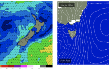
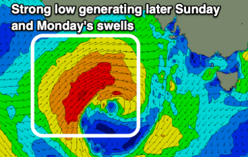
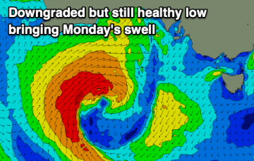
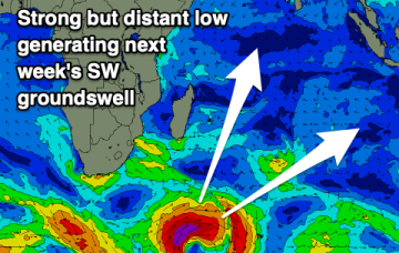
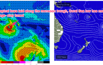
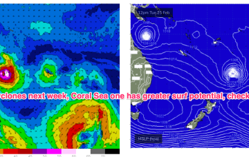
Medium term surf potential rests on these tropical lows, with the supporting tradewind belt supplying plenty of energy in the interim, focussed on the sub-tropics.