Tricky winds for the weekend, improving from Tuesday
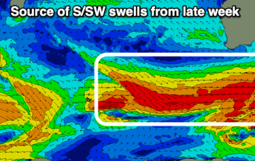
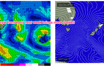
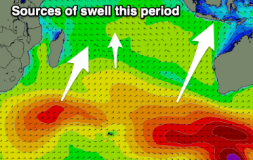
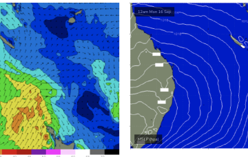
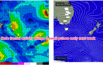
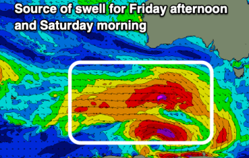
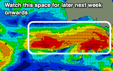
Conditions are looking dicey for the weekend and Monday, better from Tuesday.
We have a follow-up front and trough expected to push into the Tasman later Sat, this time backed by a monster high (1042 hPa) in the Bight. Steep pressure gradients will create near gales to gales in a proximate S’ly fetch and whip up plenty of sizey S swell later Sun
Today and the weekend will be fun as the current swell slowly eases.
We have a follow-up front and trough expected to push into the Tasman later Sat, this time backed by a monster high (1042 hPa) in the Bight. Steep pressure gradients will create near gales to gales in a proximate S’ly fetch and whip up plenty of sizey S swell.
The coming period isn't great for either region so make the most of the current building swell.
The coming period is mixed with the first half being average, becoming much more active from mid-late next week.
Make the most of the coming energy before things slow.
We’ve got high pressure moving across the Tasman with a much stronger dual-centred high tracking into the Bight. The current high is generating small, just surfable swells for CQ.
We’ll see another complex of S swell trains make landfall from Mon. Mostly mid period S from the frontal intrusion into the Tasman but there will be come much longer period swells in there from polar sources.
There's a bit of swell due this period and beyond with multiple swell sources.