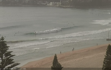
Extended run of NE windswell ahead; S'ly swell for the weekend
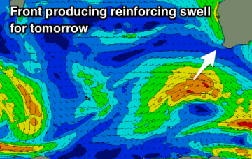
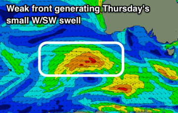
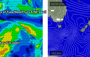
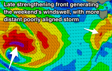
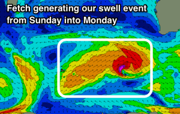
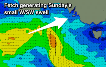
A slow moving Tasman high will deliver a fairly steady run of NE wind and NE windswell this week.
Mix of W/SW and SW swells easing slowly tomorrow with decent winds, smaller and deteriorating into the end of the week. New swell on the build from Sunday.
Our new W/SW groundswell is on the build and it'll ease through tomorrow, slowed by a small mid-period W/SW swell during the week. Windows of clean conditions across both coasts.
Inconsistent and smaller westerly groundswells this week with winds varying quite a bit with surface troughs lingering across the state. A couple of fun surf days to enjoy though.
Based on model guidance, we’re yet to see the peak swell energy from TC Mona.
A stationary trade flow through the northern Tasman Sea/Lower Coral Sea and South Pacific will become slightly enhanced with an easterly dip forming south of Fiji over the weekend. More in the Forecaster Notes.
Small pulses of N/NE windswell through the coming period for desperate surfers.
A small and weak increase in windswell for the weekend, fading once it cleans up. The only other surfable swell is a dicey W'ly groundswell for early next week.
A prolonged and OK SW tending W/SW swell event from Sunday with periods of favourable winds in selected spots.
Poor surf down South over the weekend, with a tiny though surfable W/SW swell for the Mid Coast. Better W/SW groundswell for early next week as winds improve down South.