Good to great for the South Coast
Monday, 1 September 2025
Good to great for the South Coast
Monday, 1 September 2025
The coming period looks best for the South Coast with a couple of fun days inside the gulf later week.
The coming period looks best for the South Coast with a couple of fun days inside the gulf later week.
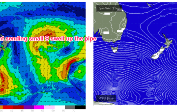
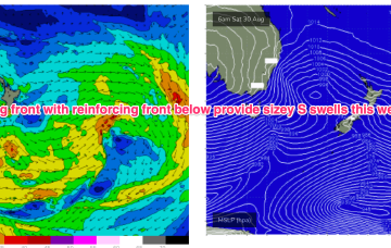
Still on track for S pulses this week for the first week of spring. No “direct hits”- it’s all wrapping into the Tasman from deep southern and fast moving fronts under Tasmania so S swell magnets in NENSW will be favoured and only the most reliable S magnets in SEQLD will see any meaningful surf.
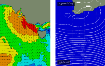
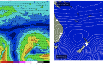
An ice shelf fetch over the weekend looked strong on paper but the extent to which winter sea ice has hindered swell generation remains a key source of uncertainty.
Besides Friday, this week looks great for surf, with the beaches coming into play with offshore winds from the weekend.
The other compounding factor for Saturday will be the presence of gusty onshore winds in the wake of the front. Yes, they will ease back and veer more W’ly but surf quality will not be high.
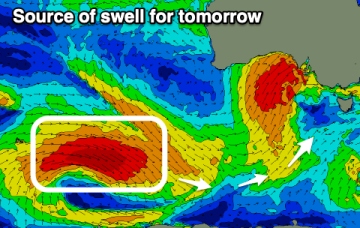
The Southern Ocean is lining up an almost endless supply of mid-latitude lows and fronts, and we’ve got waves as far as the eye can see.
A vigorous low and cold front will cross Bass Strait overnight tonight, bringing gale to storm force SW winds across the entire Victorian coast.
Plenty of energy through Tues and into Wed generated by rolling disturbances and a long zonal fetch in the screaming 50’s over the weekend .
Next weeks high pressure centre in the Tasman now looks weaker and the trade flow in the Coral Sea is weaker and more disjointed.
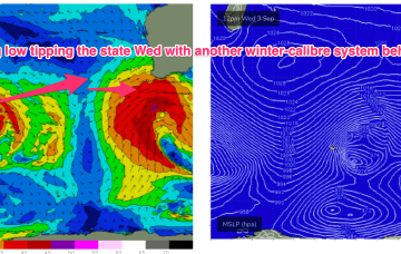
Still on track for a wintry blast this weekend as a strong cold front tied to an intense low currently west of Tasmania sweeps up over the SE overnight and enters the Tasman early tomorrow morning.